Archives de l’auteur : frogsparks

Cartes IGN sur Android 7, 8 et 9

Manifestement, depuis le 20 mars, IGN a mis à jour un certificat sur leurs serveurs, et il n’est pas compatible avec les versions d’Android inférieures à 10, ce qui fait que les cartes IGN ne se chargent plus dans MyTrails.

Il y a une méthode de contournement (à part mettre à jour la version Android lorsque c’est possible) : installer ce certificat explicitement :

  • télécharger https://www.visugpx.com/divers/certif_ign.cer sur votre téléphone
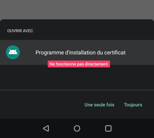
    • lors du téléchargement, Android vous proposera peut-être de l’installer directement ; ça ne fonctionne pas, il faut l’installer manuellement depuis les paramètres
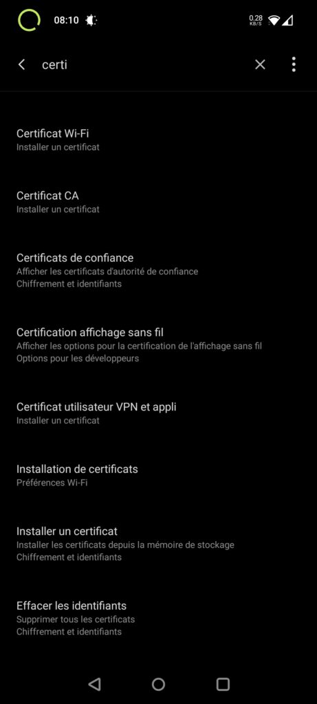
  • aller dans les paramètres d’Android et rechercher Certificat
  • sélectionner Installer Certificat CA
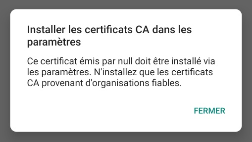
  • accepter les mises en garde d’Android
  • trouver le certificat là où vous l’avez téléchargé et l’installer

Cette solution provient de https://skitour.fr/forums/362324_2, et elle fonctionne dans une majorité de cas, mais plusieurs cas de problème ont été remontés :

  • installation impossible (on peut installer un certificat VPN ou Wifi, mais pas CA)
    • il est possible que sur certains téléphones l’installation doive être faite différemment, ou soit bloquée par des paramètres de sécurités
  • l’installation fonctionne et permet de consulter les cartes sur le site Géoportail, mais MyTrails n’utilise pas le nouveau certificat, et ne parvient donc pas à charger les cartes
    • dans ce cas, seule une mise à jour de MyTrails pourrait résoudre le problème, et ce n’est pas à l’ordre du jour car l’application n’a pas été mise à jour depuis tellement longtemps que ça nécessiterait un long travail pour un très faible nombre d’utilisateurs. Désolé si vous faites partie des utilisateurs affectés.

Dropbox support

Following an update of the Dropbox API, some features are currently unavailable. In particular, connecting a new device to Dropbox doesn’t work.

I hope to release a new version shortly to resolve.

Offline maps and GPX save location with Android 11

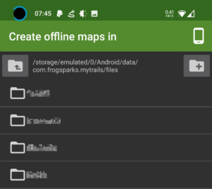
As Google continues to make it harder for applications to share data, you may have to move your offline maps and GPX save location to a MyTrails-specific folder rather than the traditional /sdcard/MyTrails.

Several users have reported that using a folder like android/media/com.frogsparks.mytrails (inside the main device storage, presumably also on a removable storage) works.

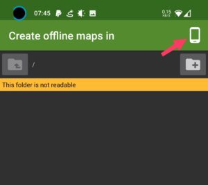
When selecting the offline map location, use the « device » button in the top-right corner to switch to that directory directly:

If you’re not using offline maps (only GPX saved tracks), you can probably stick with your usual save location, but you need to switch to the standard Android file picker (disable Use internal file picker in MyTrails > Preferences > Other).

For more general info, see this older post.

2.1.11

  • Correction de création de cartes hors-lignes payantes à calques (VTTrack sur IGN)
  • Partage de cartes à base d’URL (dans l’écran d’édition)
  • Support d’Android 10
  • Correction de la recherche Google, itinéraire et altitude

Les cartes IGN sont-elles devenues gratuites ?

Depuis le 1er janvier 2021, IGN a rendu gratuites la majorité de ses donnés, c’est une excellente nouvelle.

En revanche, le communiqué précise bien que les cartes et scans ne sont pas concernés par la gratuité. Le prix des licences IGN dans MyTrails reste pour le moment inchangé.

Les données incluant des droits de tiers ou protégées par le droit d’auteur (cartes et SCANs) ne sont pas concernées par cette ouverture

Communiqué IGN du 11 décembre

MyTrails displays extra lines on my recorded tracks

Extra lines

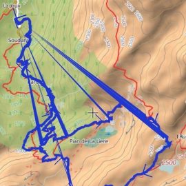
On some devices, MyTrails draws recorded tracks with lines leading back to the start of the recording. This is only a display issue, and the lines change when you zoom in or out.

For the moment, to fix this, use the toggle track mode hidden option to select the Lines mode.

If this doesn’t fix the problem, you can use the same hidden option to get back to Smooth triangles, and check that the problem is not with the recording itself.

map1.eu offline

The map1.eu servers are currently online offline.

This has happened in the past, and the server eventually came back, but there is no certainty it will be the case this time.

This server has alternated between online and offline in past weeks, and is increasingly unreliable.

Kompass map

At the moment the Kompass map is no longer working. I will attempt to find a way to get it to work again, but it’s entirely possible that won’t be successful.

As with all free maps, I can’t make any guarantees that a given map will remain available, as the map owners may stop providing it or start protecting it effectively.

GPSies is no longer usable with MyTrails

The owner of GPSies sold their web site to AllTrails, which subsequently closed the APIs that MyTrails was using to upload and download tracks. I will remove the integration in a later version of MyTrails, but for now MyTrails will just display an error when you try to use GPSies.

I’m assured that MyTrails.com.au is still operational and has no plans to shut down or sell out. Feel free to use it for all your track sharing needs (uploading and downloading).

(note that despite the fact that My Trails the web site and MyTrails the app share a name and a good working relationship, they are operated independently – if you need support for the app, use mytrails.app; if you need support for the site, use mytrails.com.au)