Author Archives: frogsparks

Play Store and VATMOSS

This a stripped-down version of the article in French.

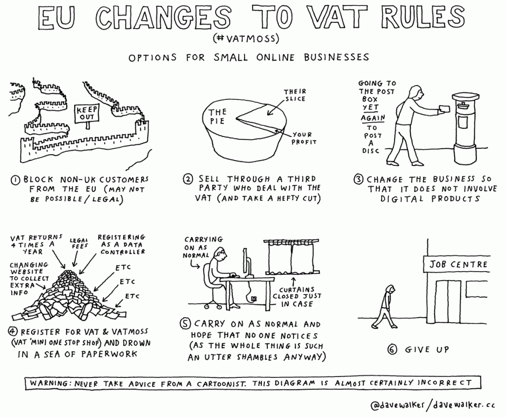
Google decided to automatically add VAT to add sales within the EU as a result of the new European VAT rules for virtual goods sales.

Because FrogSparks is a very small company, I do not collect VAT on sales (I sell VAT-free), at least in France (it’s not clear yet whether this exemption extends to other EU sales). But because of this, I also can’t deduct the VAT I pay my suppliers. This means that Google is forcing me to pay VAT twice on the map licenses.

Consequently, I have to increase prices in the Play Store for EU countries (which mechanically increases Google’s cut, and the other set of taxes I have to pay, which are based on revenue, not income, but that’s another matter).

If you would like to keep purchasing maps at the “normal” VAT-free price, you can use our web site.
vatmoss

2.0.6

  • Fixed Google Earth
  • Removed Yahoo (the old Yahoo tiles are no longer available and the new service uses a protected HERE API)
  • Optimization and fixes for map tile display
  • Fixed inability to create offline OS25k-only maps
  • Fixes and optimizations for WMS maps
  • New option to hide automatic waypoints (pause and altimeter)
  • Added support for using voice search: “Ok Google, search for Paris using MyTrails” (English-only until Google starts to support other languages)

Using machine translation to help translate MyTrails

There’s nothing wrong in using the Machine Translation system built into Weblate as a base to help the process of translating each string.

You need to be aware of some issues introduced by the automatic translation system, in particular Google Translate:

  • it may interfere with punctuation, introducing extra spaces before commas or periods, which you’ll need to remove
  • it may interfere with markup:
    • markup such as <i>italic</i> may be tuned into &lt; and other messes; it’s not dangerous but will look very odd to end-users
    • placeholders such as %1$s, %s or %d are replaced with strings generated by the application, and if they are messed up during translation, the application will not only look odd, it may crash (but only in your language, making identification more difficult), please take extra care to make sure no spaces are introduced in these placeholders and that they are not otherwise modified
  • when the source string contains line-breaks (indicated by greyed-out ↵ icons), the automatic translation may introduce non-greyed-out such icons in the translated string, which should be replaced with actual line breaks
  • another source of minor issues is the introduction of double spaces or spaces before or after the string, which I then need to clean up

I have also added support for Microsoft Translate, which may introduce fewer issues.

2.0.3

  • New track sharing community: RandoGPS (French focused)
  • Added option to search for location in OSM and IGN (French, requires online subscription)
  • Easy way to retry failed purchases (in Preferences > About > Retry purchase)
  • Bug fixes

MyTrails is always looking for a GPS signal – AKA how can I stop MyTrails?

MyTrails can record your track whether it’s visible or running in the background. Even if you’re not recording a track, MyTrails may use the GPS if you have the proximity notifications option turned on.

When you want to stop using MyTrails, you should quit it like any other application (including Google Maps), by using the back key or button. When you do this, MyTrails asks you whether you want to keep recording the track in the background. Answer ‘no’ to stop MyTrails entirely.

Back button

Back button

Back key

Back key

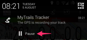
Note that MyTrails doesn’t ask about quitting if you have already paused track recording. You can also use the Pause button in the recording notification to stop recording.

Recording notification

Recording notification

If you find this confusing, you can enable a Quit option to the navigation menu in MyTrails > Preferences > Other.

If you have used MyTrails beta, it may be set to use “enhanced GPS”, which introduces an issue. Please check in MyTrails > Preferences > Sensors that enhanced location is turned off.

I made a purchase but MyTrails failed to activate it

In some very rare cases, MyTrails may have trouble activating a purchase you made via in-app purchase, so Google (or PayPal) will have charged your account but MyTrails doesn’t register that fact.

MyTrails usually warns you of the fact and suggests corrective measures; even if it doesn’t, the first things to try are:

  • make sure MyTrails is connected to your Google or FrogSparks account (MyTrails > Preferences > Accounts > Google or FrogSparks) or in MyTrails’ navigation menu
  • if you made your purchase from within MyTrails
    • trigger a new attempt to register your purchase by going into MyTrails > Preferences > About > Retry purchase (in MyTrails 2.0.3 or later – in earlier versions go to the same screen you initially tried the purchase)
  • for purchases from the web site
    • the account you used to connect to the web site (and the email address on which you received the confirmation email) matches the account to which MyTrails is connected (displayed at the bottom of the navigation menu)
  • if this doesn’t work, please contact support@wp.paour.com, providing the following information (clicking the link provides a pre-formatted email for this):
    • the email address of the account MyTrails is connected to
    • your Google Wallet (from Google’s confirmation email or wallet.google.com) or PayPal (from their email or www.paypal.com) purchase number

Compass calibration

MyTrails can use your phone’s built-in magnetometer and accelerometer to simulate a compass. However, unlike a physical compass, phones need to be periodically calibrated to provide an accurate reading of the magnetic north bearing.

There are two methods (both need MyTrails to be running with the screen on – MyTrails disables the compass when the screen is off):

Keep in mind that even after calibration, the compass is sensitive to interference: don’t place it next to ferrous metals.

Unlike a physical compass, MyTrails can automatically correct the magnetic declination to provide a reading of the geographic rather than magnetic north.

If the compass seems to rotate in the opposite direction of your real movement when you, please try using the toggle reverse compass hidden option.

In addition to the compass, MyTrails can use the GPS-derived heading, with the following caveats: it’s only active above 1m/s (too imprecise at slower speeds), and the GPS heading indicates the direction of your travel, not the direction the phone’s screen is pointing.

Another method, described by Google.